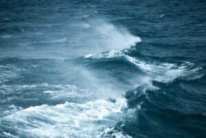

In the midst of gale warnings, waves towering at 12 feet, and wind speed peaking some scary miles per hour, hardcore surfers pack their boards and put on their winter wetsuits to prepare for the wildest swells they’d surf for the day. Other people might avoid getting near the sea during this time, but for the adrenaline junkies who crave excitement and adventure, it’s the perfect time to jump on and ride the waves. So just what is a gale warning?
But as exhilarating as it may seem, surfing in these conditions can become a dangerous scenario that could lead to drowning and death. Surfing in these conditions can be comparable at times to that of a tropical cyclone.
The ideal wind speed and force of offshore winds for surfing averages at 20-25 miles per hour depending on location. Any stronger than that will mean a storm warning, hazardous conditions and splashes of sea spray and erratic waves that can be fatal if you’re a beginner who’s not used to this kind of surfing.
For this reason, forecast agencies such as the National Weather Service issue an alert known as ‘gale warnings’ to warn certain areas of occurring and potential gale winds with speed that averages from 34 to 47 knots. This allows surfers, mariners and people living near the sea to take safety precautions, such as staying away from the sea or lakes during this time. Forecast agencies will alert when a developing gale is approaching, when the gale warning remains, and throughout as the warning remains in effect.
Whether you’re a surfer or just a curious mind, in this article you’ll learn more about different kinds of alert warnings, safety measures you can take, and real stories about people who brave the waves in gale-force conditions. Let’s get started!
Table of Contents
What is a Gale Warning?
Ever seen two red pennants flying or posted at your local beach during windy days? That, my friend, is the United States maritime flag system that indicates there’s a gale warning in your location.
As mentioned earlier, a gale warning is an alert that is issued whenever the maritime is experiencing or about to experience winds of gale-force that is within the range of 34 knots (63 km/h or 39 mph) to 47 knots (87 km/h or 54 mph), with a sustained wind force of ten minutes or more.
So how are gale winds measured? In 1805, a British Royal Navy known as Sir Francis Beaufort devised a scale that can help mariners and sailors estimate wind force through observation without having to use any kinds of wind tools. His scale ranges from 0 to 12 depending on the wind strength, which you can also see from the table below. (Reference: National Weather Service)
| Force | Speed | Knots | Description | Sea Specifications |
| 0 | 0 to 1 | 0 to 1 | Calm | Sea is like a mirror |
| 1 | 1 to 3 | 1 to 3 | Light Air | Water has ripples; scales appear but without foam crests |
| 2 | 4 to 7 | 4 to 6 | Light Breeze | Small and more pronounced wavelets; Crests appear glassy but don’t break |
| 3 | 8 to 12 | 7 to 10 | Gentle Breeze | Larger wavelets; crests start to break; seafoam has a glassy appearance; scattered white horses |
| 4 | 13 to 18 | 11 to 16 | Moderate Breeze | Small waves are becoming larger; white horses become fairly frequent |
| 5 | 19 to 24 | 17 to 21 | Fresh Breeze | Moderate and long-formed waves; lots of white horses are formed |
| 6 | 25 to 31 | 22 to 27 | Strong Breeze | Large waves are starting to form; white foam crests are more frequent |
| 7 | 32 to 38 | 28 to 33 | Near Gale | Sea heaps up; white foam from breaks are blown in streaks along the wind’s direction |
| 8 | 39 to 46 | 34 to 40 | Gale | Moderate waves with greater length; the edge of crests begin to break; the seafoam is blown in streaks along the wind’s direction |
| 9 | 47 to 54 | 41 to 47 | Severe Gale | High waves with dense streaks of foam; wave crests begin to topple; sea sprays may not affect visibility |
| 10 | 55 to 63 | 48 to 55 | Storm | Higher waves with long overhanging crests; the surface of the sea becomes white in appearance |
| 11 | 64 to 72 | 56 to 63 | Violent Storm | Exceptionally high waves with edges of the crests blown into froth; the sea is completely covered in white, long patches of foam |
| 12 | 72 to 83 | 64-71 | Hurricane | Air is fully covered with foam and spray; sea completely white; visibility is very much affected |
How are gale winds formed?
Gale winds are usually associated with low-pressure areas. They may also come from anticyclones (not to be confused with a typical cyclone), or from sudden drop and rapid transition from high pressure system to low pressure. Typically, if a certain area has a lower pressure system than the areas surrounding it, the wind will blow towards the low-pressure area, and the sudden difference in temperature results in the formation of gale-force winds.
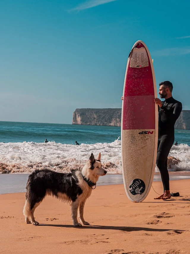
Surfing with Gale-Force Winds
Do surfers actually surf in places with gale warnings? During a wind speed force of 8, people living near the shore often experience hazardous situations such as their roofs or any light construction house materials getting blown off by the strong winds. It can get scary, but you’d be surprised by how much people are thrilled with this kind of weather condition.
Some surfers compare gale-force winds similar to winter surfing or riding big waves spots like Pipeline and Mavericks. Let’s take the locals of the Great Lakes, for instance. For them, the best surfing months of Lake Michigan happen every October and November when low-pressure systems fuel their strong winds and create the biggest barrels and gnarliest waves.
Surfing with gale winds could be tempting, but keep in mind that nature can be unpredictable and dangerous. A day out in a rough sea might be your last if you don’t heed the gale warnings of the local authorities, so use your best judgment at all times.
In 2019, news broke about a kitesurfer being blown off and carried by strong winds 400 feet away and propelled into the wall of a home causing his death. According to the officials, there was a sudden storm in the area, and there were no warnings of the strong winds earlier that day.
Safety Measures
Gale warnings are forecasted to alert the residents of a certain area of strong winds that can be dangerous and fatal. During this time, it’s best to stay out of the water; however, if you’re resolved and determined to surf during this extreme weather condition, take note of the following safety measures.
Check local forecasts and updates
While you may already know the land and sea conditions for the day, it won’t hurt to keep tabs on the weather so you get to know any sudden changes in the weather. You can look through surf forecasting websites or listen to radio broadcasts.
In the United States, the National Weather Service gives frequent reports on areas experiencing or about to experience gale-force winds. For Canada, it’s the Environment and Climate Change Canada and the Meteorological Service of Canada. The United Kingdom, on the other hand, has the Meteorological Office to issue gale warnings. They also broadcast weather reports on the radio four times a day at 198 kHz BBC Radio Channel 4.
Know what the warning flags and markers mean
The NOAA or National Oceanic and Atmospheric Administration have developed a coastal warning display program that features the use of flags to warn residents of the hazardous wind conditions in their coastal area. Check out the photo below for reference.

As you can see, a gale warning signal consists of two red pennants that can often be seen at the entrance of the beach or near the lifeguard stand. Meanwhile, a single red pennant refers to a small craft advisory which means the winds have reached a force less than a gale within the span of 12 hours; therefore small boats are advised to seek anchorage, dock on land, or avoid sailing out to the sea.
Aside from the pennants and signals, you’ll also see markers and black and white checkered flags at the beach you’ll be surfing on. These indicate the safe zones, so make sure you stay within their range.
Surf with someone/ Stay within the lifeguard’s range of vision
In the worst-case scenario that you drown, fall off your surfboard, or get wiped out by the gnarly swells, there should be someone with you to rescue or help you get back on your board. But if you don’t have someone to surf with, then you must only surf or swim in places where there’s a lifeguard patrolling. Stay within the zones where they can see you at all times.
Make sure you’re a good swimmer
The rip currents during extreme wave conditions constantly change and can be unpredictable. If you get under a current, the panic and constant paddling that you’ll do to try and get out of it may leave you exhausted and cause you to drown. As a surfer, being a good swimmer can save your life.
Wear protective clothing and gear
Life jackets, helmets, thick neoprene wetsuits, and boots are your best defense in drowning and getting hypothermia during surfing in a place with a gale warning. The strong winds will make it hard for balancing; therefore, a good leash will also come in handy to keep your board from floating away if you fall off from it.
Know your limits
Life is more valuable than one good surfing session. That said, if you think it’s not safe to surf or swim on a beach or lake with a gale warning, trust your instinct and just call it a day.
Frequently Asked Questions
Q: What is considered a gale warning?
A gale warning alert is issued when the wind speed is within the range of a sustained wind force of 34 to 47 knots that lasts for a 10-minute period. (Not to be confused with gust winds that have a fluctuating wind speed of only 10 knots.) When gale warnings are reported, mariners and people living on the seafront are advised to take precautionary measures and avoid going near the sea for safety purposes.
Q: Can you surf in a place with a gale warning?
Gale winds are strong; hence why some surfers like to surf during these kinds of extreme weather conditions. During this time, however, it’s advisable to stay out of the water as the waves and rip currents can be erratic and deadly.
Luke Morris is an avid athlete and the driving force behind Surfhungry, a vibrant online platform dedicated to sharing the joy and passion of surfing and water sports with enthusiasts around the world. With a deep-rooted love for the ocean and a lifelong commitment to riding waves, Luke’s journey as a surfer has inspired him to create a community where like-minded individuals can come together to celebrate their shared passion.